Introducing The Italian Alps

The Alps are generally divided into the Western Alps and the Eastern Alps. The higher Western Alps are located in Italy, France and Switzerland and have a central chain which is curved and a shorter than their Eastern counterpart. The Eastern Alps have a main ridge which is long and broad. They are situated in the 6 countries of: Italy; Austria; Germany; Liechtenstein; Slovenia; Switzerland. Defining the borders of the larger Alp groups is problematic, many different descriptions exist in literature. The information seems to change according to whether the boundaries have been classified using geographical, geological or historical parameters. Traditionally, a divide seems to exist between the Western Alps and the Eastern Alps. This uses the Splügen Pass (Italian: Passo dello Spluga) on the Swiss-Italian border, together with the Rhine to the north and Lake Como in the south, as the defining features. As the Splügen Pass is situated more or less half-way along the main chain, it makes a convenient geographical boundary.

The highest peak of the Western Alps is Mont Blanc, 4,810 metres (15,774 ft) and the highest peak in the Eastern Alps is Piz Bernina, 4,052 meters (13,294 ft).

Monte Bianco (Mont blanc) Italian side

Italy shares Mont Blanc (highest peak in the Alps) with France and Monte Rosa (second highest in the Alps) with Switzerland.

Follow piedmont_phil on Twitter

This is a list of mountains in the Italian alps, ordered by elevation. It is intentionally not completely accurate as some mountains situated only partially in Italy have been omitted. See our section on Piedmont Peaks for those which are within a few hours drive of our location.

For more information on alpine peaks follow this link.
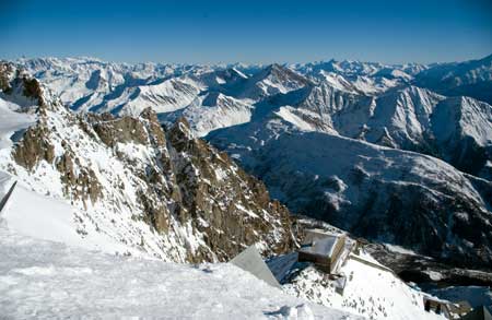
high alpine peaks from Monte Bianco glacier

Mountain/Country Borders

Range

Elevation

Mont Blanc or Monte Bianco  Italy/France

The highest mountain in Western Europe lies between the regions of Aosta Valley Italy and France. The location of its summit is controversial. In a convention between France and Kingdom of Sardinia, in Turin (1861), the border was fixed on the highest point of Mont Blanc on the Italian side. This was the last official definition of its border. French maps often conveniently do not respect this solution. The two famous towns near Mont Blanc are Chamonix France and Courmayeur, in the Aosta Valley in Italy. The 11.6 km Mont Blanc Tunnel runs beneath the mountain between these two towns. Mont Blanc is one of the most visited tourist destinations in the world, and for this reason, it is threatened.

Graian Alps

4810m

15771ft

Monte Rosa or Dufourspitze. Piedmont and Aosta in Italy and Valais in Switzerland. More of a massif than a single mountain, it has 10 summits over 4000m. The highest peak Dufour is named after Henri Dufour an army general, map maker and co-founder of the Red Cross. It dominates the horizon its permanent glaciers shining in the sun. Plateau Rosa, about 3,500 meters high is a summer ski resort, with permanent snow all year. It is connected via aerial tram to Cervinia. The main mountain and ski resorts surrounding its south side are situated mainly under the glaciated east face about 2,500 meters high. There is good infrastructure. Rosa is not difficult to climb but sudden weather changes and crevasses in its extensive glaciers can make it dangerous.

Pennine Alps

4634m

15203ft

Nordend Italy /Switzerland 

The third highest mountain in the Alps and part of the Monta Rosa massif. It is the most northern of Monte Rosa peaks, located on the Swiss Italian border. The normal route starting from the Monte Rosa hut is not difficult for experienced climbers but good weather is a must.

Pennine Alps

4609m

15121ft

Lyskamm Italy/Switzerland in the Monta Rosa massif.

Pennine Alps

4538m/14852ft

Monte Cervino or Matterhorn Italy/Switzerland Towering over the Swiss town of Zermat and the Italian town Breuil-Cervinia in the Val Tournanche, Monte Cervino has four faces, facing the four compass points. The faces are so steep that only small patches of snow and ice cling to them. Avalanches are common sending the snow to accumulate on the glaciers at the base of each face. In summer it is impossible to resist the temptation to walk or hike in the mountains along paths recently arranged by the Mountain Community. A summit climb should only be attempted by very experienced climbers. In the winter it becomes the terrain of skiers.

Pennine Alps

4478m

14693ft

Castor Italy/Switzerland

One of the easiest 4000 meter peaks in the Alps so expect crowds in high season. Klein-Matterhorn cable car-station at 3883m is where most people start often with guides as all sides are heavily glaciated.

Pennine Alps

4228m/13871ft

Dent d’Herens Italy Switzerland

Dent d'Hérens is a neighbour of the Matterhorn on the border ridge between Italy and Switzerland

The normal route to the summit is on Italian side Place Moulin in Valpelline valley Place Moulin in (Val d'Aoste region). Less often climbed because its summit is less known.

Pennine Alps

4171m

13684ft

The Gran Paradiso Italy

www.parks.it/parco.nazionale.gran.paradiso

Gran Paradiso is the highest peak situated in the Gran Paradiso nature park. At 4061m it is the highest mountain entirely within Italy and sits in one of the most idyllic National Parks in the Alps. The peak is very popular with walkers, skiers and mountaineers but manages to keep a feeling of remoteness that belies its accessibility. The most convenient airport is Turin Caselle. Geneva Airport is also a good option and the journey time from there to the edge of the park is about 90 minutes (through the Mont Blanc tunnel).

Grain Alps

4061m

13323ft

Aiguille de Boinnassay France/Italy,

Aiguille de Bionnassay is the last 4000 m peak on the Mont-Blanc ridge in western direction. In Italy the start point is Courmayeur.

Graian Alps

4052m

13293ft

Cima Ortles Italy

The 7th highest mountain in the Eastern Alps in Northern Italy but the highest point in the Trentino-South Tyrol. Ortler’ This is a high, glaciated range that offers excellent snow and ice climbing, particularly in the Dello Stelvio National Park, just west of the city of Bolzano. Also known by its German name ‘ Ortler]

Ortler Alps

3905m

12811ft

Monte Viso Italy (view from our vineyard)

The highest peak in the Cottian Alps.  Although Monte Viso is entirely in Italy, the French border is very close and the French like to consider it is part of Queyras mountains too. It is an isolated peak surrounded by fine scenery. Its rocky slopes ascend in very steep tiers. Located fifty miles southwest of Turin, it has extra appeal of feeling more isolated than other areas of the Alps that have been more intensively developed. The long trek to the mountain provides excellent panoramic views. One of its famous passes, a bridle path called Col de la Traversette is the route that Napoleon took with his army and supplies to invade Italy, nearly two centuries ago.

Cottian Alps

3841m

12601ft

Weisskugel Italy/Austria

Weißkugel (or Palla Bianca in Italian) is the second highest mountain in the Otzal Alps and the third highest mountain in Austira. It lies on the border between Austria and Italy. It features many glaciers. The easiest way to climb it is over the south side of it. It was first climbed in 1850 by J A Specht, Leander Klotz, and Nicodem Klotz.

Due to its central location, it has one of the best views in the entire Alps.

Ötztal Alps

3739m

12291ft

Presanella Italy

The Adamello-Presanella Group is part of the Southern Limestone Alps which are located in the provinces of Trento and Brescia. The name stems from its highest peaks: Adamello and Presanella.

Presanella & Adamello

3558m

11673ft

33554m

11661ft

Rochemelon Italy France

Situated on the French/Italian border 50 km (30 mi) west of Turin, this high mountain boasts the world’s first undisputed recorded first ascent date in the world. The honour goes to Bonifacius Rotarius (of Asti) who on Sept 1 1358 transported a small metal image of the Holy Virgin in gratitude of surviving his captivity in the Holy Lands during the Crusade. Now the summit has an annual 5th Aug pilgrimage. A three meter high statue of the Virgin Mary was erected there in 1899. The summit of Rochemelon solely Italian, as is the upper first kilometer of Glacier de Rochemelon, this approximately 4 square kilometers constitutes the only Italian territory portion of the Rhone River basin. Ease of access of this impressive high mountain means it is one of the most visited mountains in the western alps.

Graian Alps

3538m

11607ft

Marmolada Italy

www.marmolada.com www.trentino.to.it

Also called the “Queen of the Dolomites”, it is highest mountain in the Dolomites. Along its west to east ridge are several summits including: Punta Penia (3,343 m), Punta Rocca (3,309 m), Punta Ombretta (3,230 m), Monte Serauta (3,069 m), and Pizzo Serauta (3,035 m). An aerial tramway goes to the top of Punta Penia.

It is known for its sheer cliffs on the south end and the Marmolada Glacier on the north side, the only large glacier in the Dolomites. Before WW1 the Austrian/Italian border ran over Marmolada, forming part of the frontline. As the glaciers retreat, soldiers' remains and belongings have been found. A good point to start for climbing/hiking on Marmolada is Fedaia Pass (2054 meters), situated between Canazei and Malga Ciapela (the start point of Punta Rocca cable car). There is a very pretty lake at the pass.

Dolomites

3344m

10968ft

Monte Antelao Italy

Known as the “King of the Dolomites” it is the highest mountain in the eastern Dolomites and situated southeast of the town of Cortina d’Ampezzo. Antelao is steep, rocky, and pointed with dramatic drops to the nearby valleys.

The easiest route is from the north, known as the "Laste", a steep, narrow ridge which involves a good deal of exposure. There are two historic trials possible from Cortina, one  that crosses the military installations from World War One, and another trail leading to an amazing dinosaur footprint dating back 220 million years ago.

Dolomites

3264m

10708ft

Cima Tosa Italy

The highest mountain of the Brenta Group. The Brenta's Dolomites are known for their unique system of via ferrata, Italian for 'Iron Way'. In the WW1 the Dolomite mountains formed the frontier between Austria and Italy. The Italian soldiers installed fixed cables and iron rung ladders throughout the mountains. Via Ferrata are now created throughout the Alps. These provide a great opportunity to cover ground not normally accessible to less experienced rock climbers as steel cables are provided for you to clip into for safety. There is no mountain with comparable height south of the Cima Tosa. If the weather is kind the summit rewards you a splendid panorama to the glacier mountains of the Adamello-Presanella group and the lower alps around Lake Garda.

Brenta Dolomites

3176m

10410ft

Cima Dodici Italy

The Cima Dodici is the highest mountain of the Chain. Located in the south east Trentino, in "Altipiani-CAtena di cima dodici", between Rovereto and Calliano. It belongs for a short stretch to Lagarina Valley an area ruled over by Monte Finocchio. Nature is all around with woods and meadows rich in flora and fauna and mountains that enjoy both sunshine and beautiful views. The Autonomous Province of Trento has taken steps to protect the environment you must observe the regulations in force http://www.summitpost.org/mountain/rock/155367/cima-dodici.html

Vicenza Alps

2336m

7664ft

Home

New wine offers

Great Piedmont Wines delivered to your door(UK only, sorry)

click to order

HOME | ACCOMMODATION | ABOUT PIEDMONT | BUY OUR WINE | FOOD | PICTURES

SPECIAL EVENTS 2008 | FRIENDS & NETWORKS | NEWS & REVIEWS | LINKS | CONTACT US

site map downloadable vineyard calander

Download our 2008 brochure about our Piedmont B&B and what to see and do in Piedmont in pdf format

italy luxury apartment vineyard

Moscato d'Asti harvest 2007 - clik4pics

Piedmont Barbera d'Asti harvest 2007 - clik4pics

vineyard courses - Winter sales - food & wine -Special events and breaks

we wish you very a pleasant stay in piedmont

::adCenter::